57,064  PAGES BROWSED TODAY PAGES TODAY 103  ANTIQUES UPLOADED TODAY NEW ARRIVALS
ID #SA1082128
SOLD
Email
Save
17th Century Road Map of Oxford to Cambridge John Ogilby
Antique Furniture Direct
sold SA1082128
Sorry, but this item has been sold.
Antique Furniture Direct

Antique Furniture Direct

Sellingantiques Verified Since Aug 2013
View Dealers Stock Page
Id #SA1082128
PDF SHARE
SAVE

17th Century Road Map of Oxford to Cambridge John Ogilby

17th century
Description

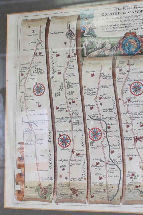
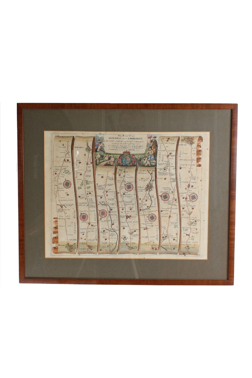
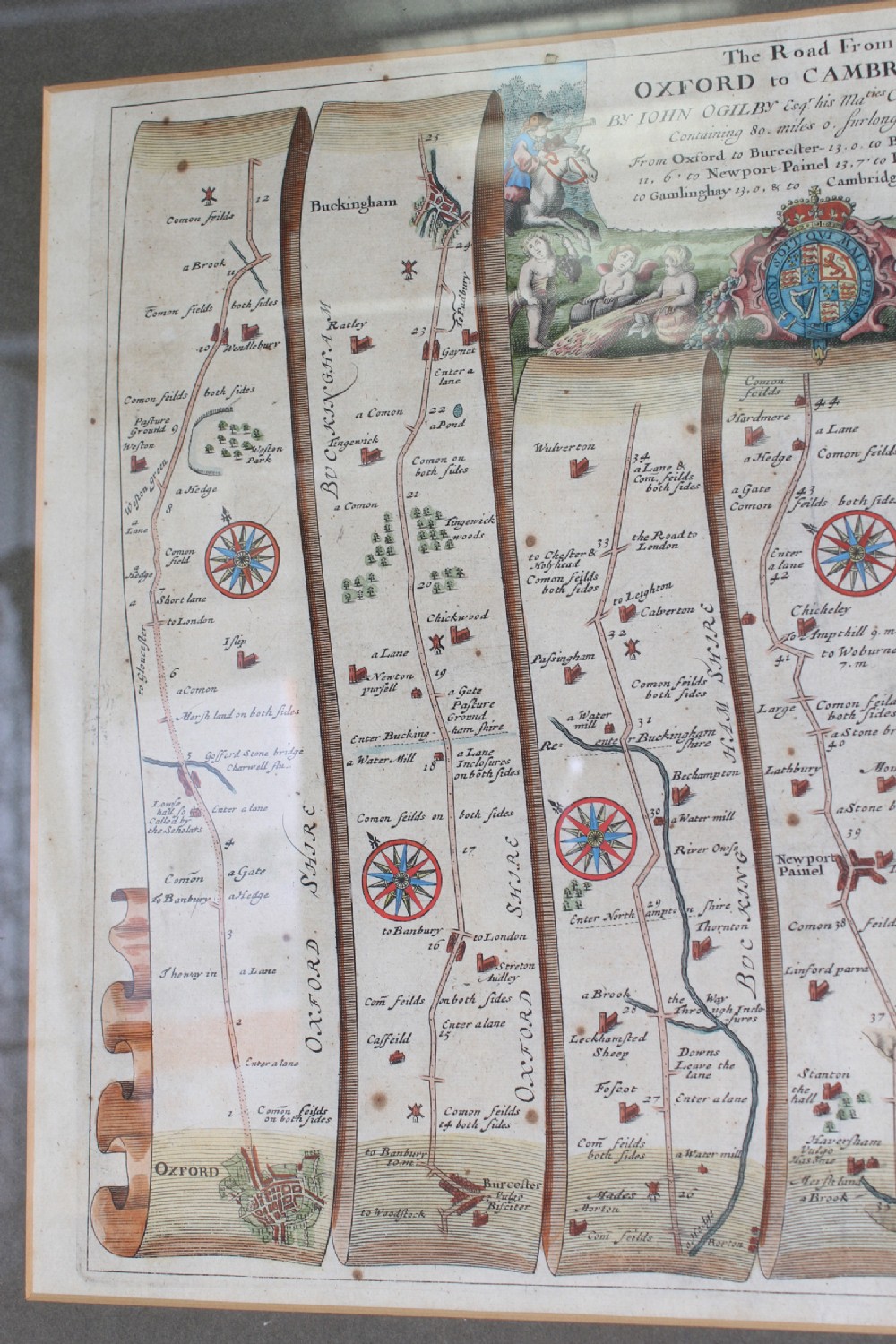
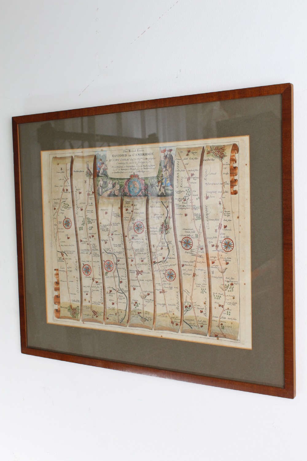
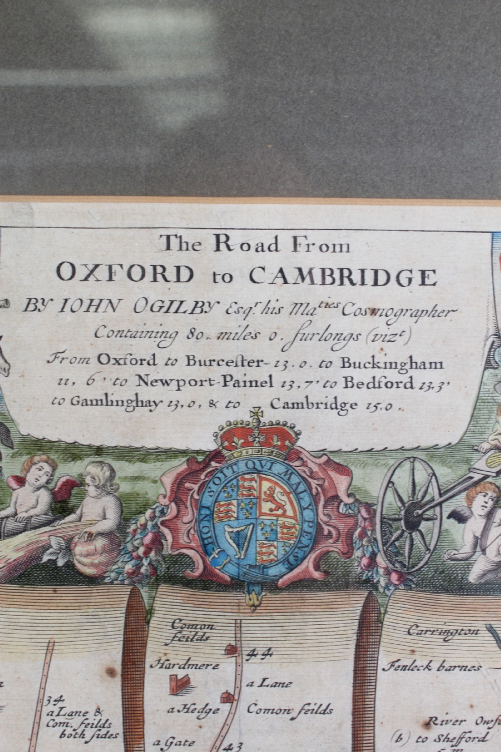
A handsome large antique 17th century strip map with later hand colouring, titled “The Road from Oxford to Cambridge”, from the first road atlas of England and Wales, by noted mapmaker John Ogilby (1600-1676).

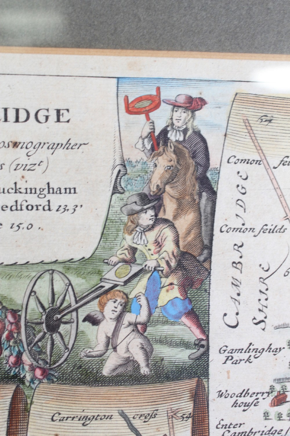
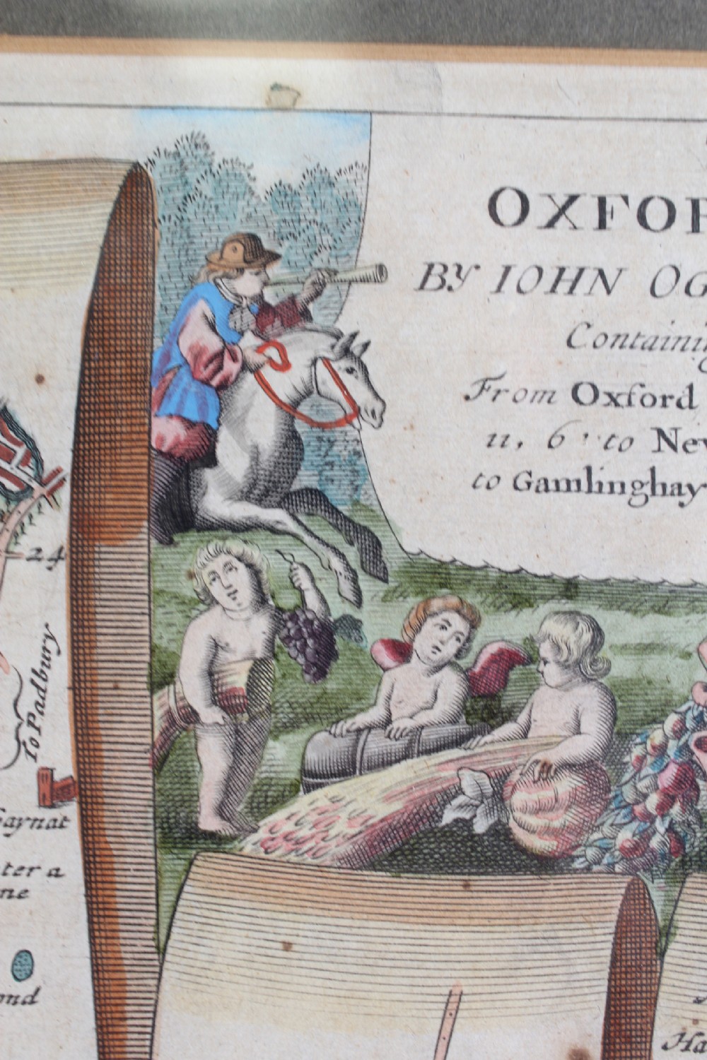
John Ogilby was Cosmographer to King Charles II and his publication “Britannia” was the first national road atlas of any country in Western Europe. He designed an accurate and easy to use map system which reads from bottom to top and left to right. Ogilby’s “Britannia” atlas was also truly ground-breaking in its time, as it was the first survey of roads in the British Isles and marked the first use of the so-called “Waywiser”, a wheeled device, one complete revolution of which marked one yard. This map features a decorative cartouche showing a surveyor using a “waywiser”.
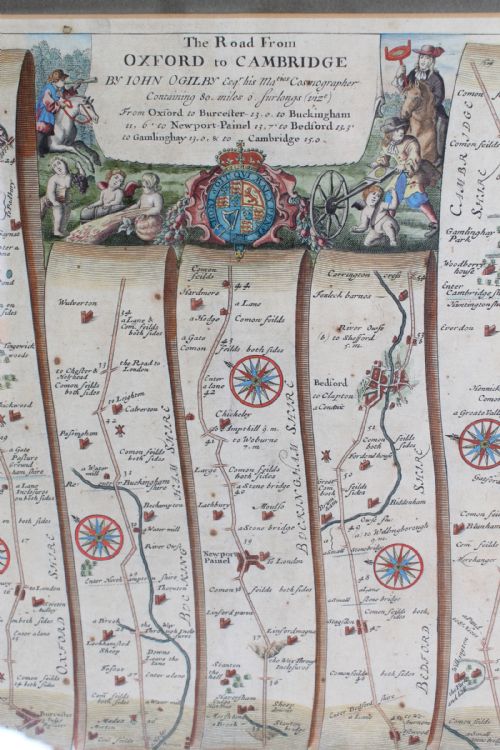
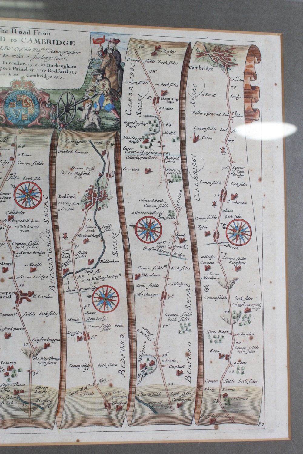
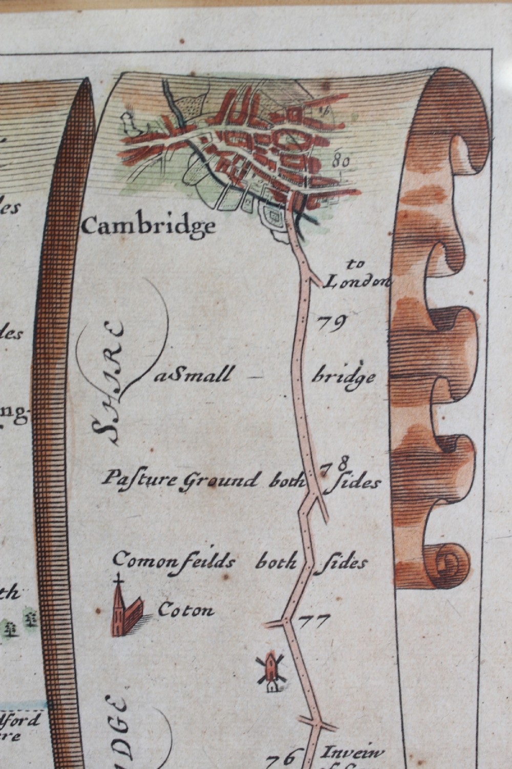
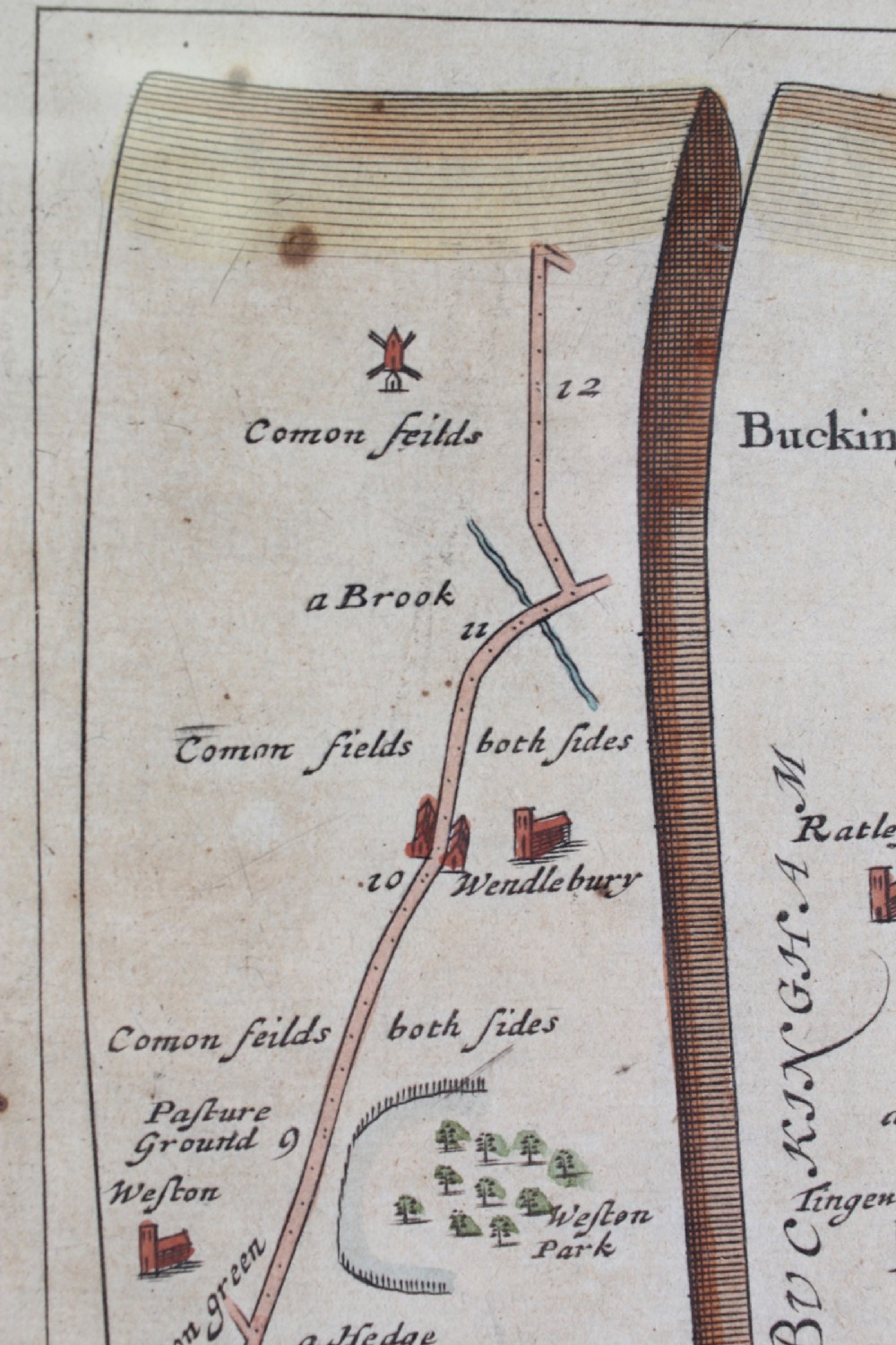
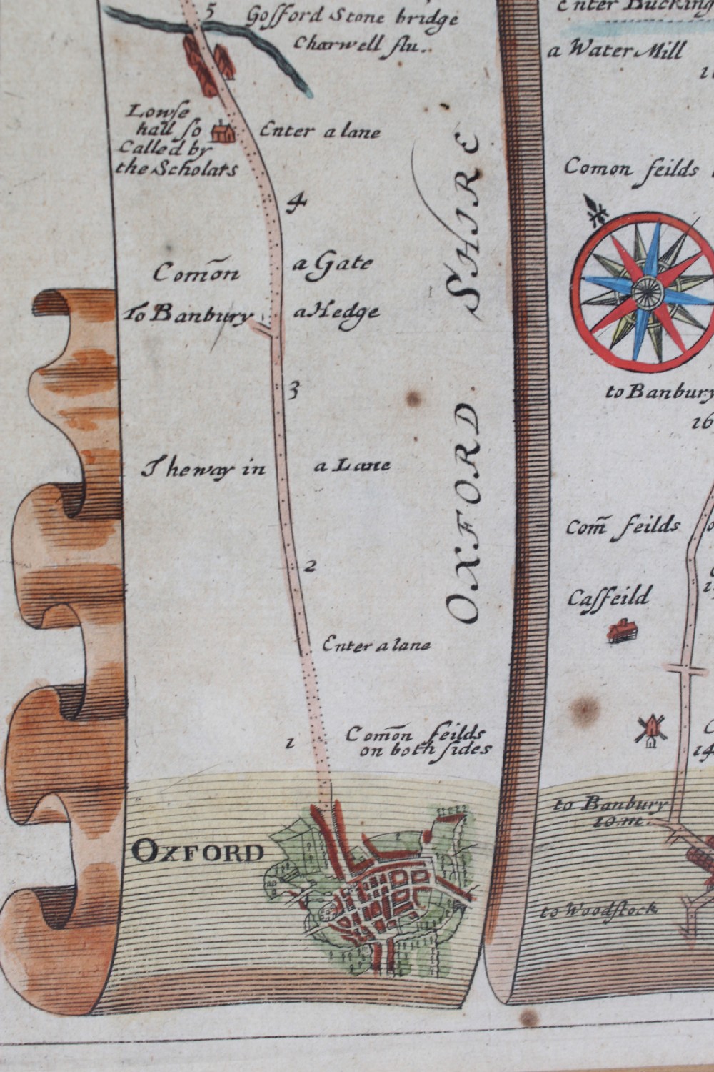
The road commences at Oxford and runs through Bicester, Buckingham, Newport Pagball, Bedford and Gamlingay and ends at Cambridge. Of the 100+ maps in the published atlas, this may well be the most popular, showing as it does the way between the two best known university towns of the age. Would make a wonderful graduation gift.
Construction/Wood:

Framed

Condition Report:

Feint crease mark to centre. Age spots and oxidization commensurate with age. The hand colouring is attractive. A few marks to frame.

Dimensions:

Frame Depth: 2cm

Frame Height: 51cm

Frame Width: 61cm

Map Height: 35cm

Map Width: 46cm

Physical Dimensions
Height
51cm (20.08")
Width
61cm (24.02")
Depth
2cm (0.79")
Declaration

Antique Furniture Direct has dated this piece to the 17th Century.

Reference Numbers
Sellingantiques Reference
SA1082128
Dealers Notes

Purchase Items on Our website: ----- www.AntiqueFurnitureDirect.co.uk ------

- UK Wide Delivery via Courier - £35 Mainland England

+ Additional Items delivered FREE

- Mainland Scotland / Wales Delivery £50

- Rest of the World please contact us for a shipping quote

- Call Rob - 07528604958

- If you do not get a reply within 24HRS Please Call Us

- Well Established Family Run Business

-30 Day No Quibble Returns Policy

- www.AntiqueFurnitureDirect.co.uk

Description
A handsome large antique 17th century strip map with later hand colouring, titled “The Road from Oxford to Cambridge”, from the first road atlas of England and Wales, by noted mapmaker John Ogilby (1600-1676).
John Ogilby was Cosmographer to King Charles II and his publication “Britannia” was the first national road atlas of any country in Western Europe.
Antique Furniture Direct

He designed an accurate and easy to use map system which reads from bottom to top and left to right. Ogilby’s “Britannia” atlas was also truly ground-breaking in its time, as it was the first survey of roads in the British Isles and marked the first use of the so-called “Waywiser”, a wheeled device, one complete revolution of which marked one yard. This map features a decorative cartouche showing a surveyor using a “waywiser”.

fig 1. 17th Century Road Map of Oxford to Cambridge John Ogilby

The road commences at Oxford and runs through Bicester, Buckingham, Newport Pagball, Bedford and Gamlingay and ends at Cambridge. Of the 100+ maps in the published atlas, this may well be the most popular, showing as it does the way between the two best known university towns of the age. Would make a wonderful graduation gift.

fig 2. 17th Century Road Map of Oxford to Cambridge John Ogilby

Construction/Wood:

Framed

Condition Report:

Feint crease mark to centre. Age spots and oxidization commensurate with age. The hand colouring is attractive. A few marks to frame.

Dimensions:

Frame Depth: 2cm

Frame Height: 51cm

Frame Width: 61cm

Map Height: 35cm

Map Width: 46cm

Height
51cm (20.08")
Width
61cm (24.02")
Depth
2cm (0.79")
Date of Manufacture

Antique Furniture Direct has dated this piece to the 17th Century.

Reference Numbers
Sellingantiques Ref
SA1082128
Antique Furniture Direct
Sellingantiques verified Since Aug 2013
Dealer Profile

You can view the stock and full dealer information on the Antique Furniture Direct Profile Page
PDF SHARE
SAVE
17th Century Road Map of Oxford to Cambridge John Ogilby
1 / 13
Archive I 17th Century Road Map of Oxford to Cambridge John Ogilby
17th Century Road Map of Oxford to Cambridge John Ogilby
Archive II 17th Century Road Map of Oxford to Cambridge John Ogilby View II
Archive III 17th Century Road Map of Oxford to Cambridge John Ogilby View III
Archive IV 17th Century Road Map of Oxford to Cambridge John Ogilby View IV
Archive V 17th Century Road Map of Oxford to Cambridge John Ogilby View V
Archive VI 17th Century Road Map of Oxford to Cambridge John Ogilby View VI
Archive VII 17th Century Road Map of Oxford to Cambridge John Ogilby View VII
Archive VIII 17th Century Road Map of Oxford to Cambridge John Ogilby View VIII
Archive IX 17th Century Road Map of Oxford to Cambridge John Ogilby View IX
Archive X 17th Century Road Map of Oxford to Cambridge John Ogilby View X

Archive XI 17th Century Road Map of Oxford to Cambridge John Ogilby View XI
Archive XII 17th Century Road Map of Oxford to Cambridge John Ogilby View XII
Archive XIII 17th Century Road Map of Oxford to Cambridge John Ogilby View XIII
Enlarged Archival View
Telephone 07528 604 958
Location
Leeds
Yorkshire
United Kingdom

By apointment only.
Verified Since Aug 2013
Items For Sale 118
Items Sold 2,950
Antique Furniture Direct
Verified Since Aug 2013
View Dealer Info
Location: Leeds, Yorkshire, United Kingdom, , By apointment only.
Verified
Aug 2013
For Sale
118
Sold
2,950
17th Century Road Map of Oxford to Cambridge John Ogilby
Ref: SA1082128
17th Century Road Map of Oxford to Cambridge John Ogilby
Detail View 1
Detail View 2
Detail View 3
Detail View 4
Detail View 5
Detail View 6
Detail View 7
Detail View 8
Detail View 9
Detail View 10
Detail View 11
Detail View 12
Archival Detail
Every single antique dealer on our platform is individually approved by our internal team. We verify their professional trade history, ethical standards, and photographic quality to ensure a secure, high-standard buying environment. Upon joining, every dealer agrees to a strict 9-point code of conduct. While issues can occasionally arise, our dealers typically resolve them swiftly and directly with the buyer. In fact, since our founding in 2002, Sellingantiques has only had to step in to help resolve an issue on roughly five occasions—a true testament to the quality of our dealers and their dedication to your happiness.
Our dealers are highly experienced in packing and shipping fragile, high-value antiques. Because you are in direct contact with the dealer, you will be able to easily go through all available shipping and insurance options together to ensure your item arrives safely.
Antiques are the ultimate green purchase. By choosing historical pieces over newly manufactured goods, you completely eliminate the carbon footprint of modern mass production while preserving exceptional, timeless craftsmanship.
items
Add keywords to the filter
Price
£100
£250000
Era
Movements
Material
Origin
Stock Location
Freshness
Online Payments
Categories