28,922  PAGES BROWSED TODAY PAGES TODAY 74  ANTIQUES UPLOADED TODAY NEW ARRIVALS
ID #SA1055748
FOR SALE
£325
Email
Save
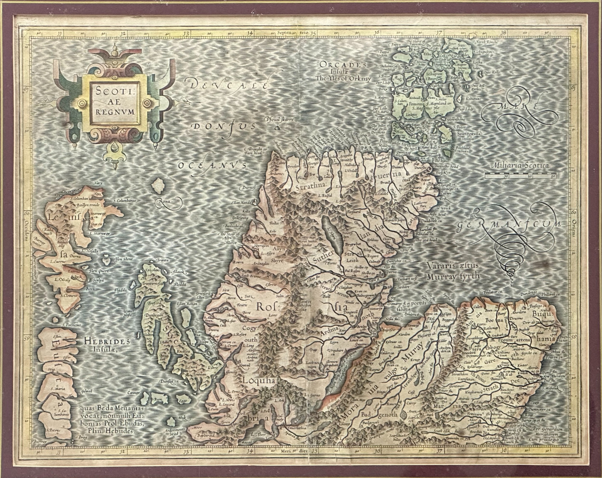
Gerard Mercator (Flemish 1512-1594) a Map of the North of Scotland Printed C.1683
Jeckyll & Co
for sale €380     $413
£325

Jeckyll & Co

Sellingantiques Verified Since May 2022
View Dealers Stock Page
  • About Us
    Instagram: jeckyllandco
Id #SA1055748
PDF SHARE
SAVE

Gerard Mercator (Flemish 1512-1594) a Map of the North of Scotland Printed C.1683

17th century
For Sale by Jeckyll & Co
Description

A copper-engraved map with hand-colouring, first published in 1585.

Made in two sheets with some minor rubbing at the join near the base.

Presented within a burgundy-coloured mount and gilt frame

Please let me know if you have any questions, the map can be easily packed and posted at cost price, for around £18 within the UK.

Follow us on Instagram: jeckyll_and_co

Physical Dimensions
Height
35cm (13.78")
Width
46cm (18.11")
Declaration

Jeckyll & Co has dated this Antique Mercator Scotland Map to the 17th Century.

Reference Numbers
Sellingantiques Reference
SA1055748
Description
A copper-engraved map with hand-colouring, first published in 1585.

Made in two sheets with some minor rubbing at the join near the base.

Presented within a burgundy-coloured mount and gilt frame

Please let me know if you have any questions, the map can be easily packed and posted at cost price, for around £18 within the UK.
Jeckyll & Co

Follow us on Instagram: jeckyll_and_co

Height
35cm (13.78")
Width
46cm (18.11")
Date of Manufacture

Jeckyll & Co has dated this Antique Mercator Scotland Map to the 17th Century.

Reference Numbers
Sellingantiques Ref
SA1055748
Jeckyll & Co
Sellingantiques verified Since May 2022

Instagram: jeckyllandco

Dealer Profile

You can view the stock and full dealer information on the Jeckyll & Co Profile Page
PDF SHARE
SAVE
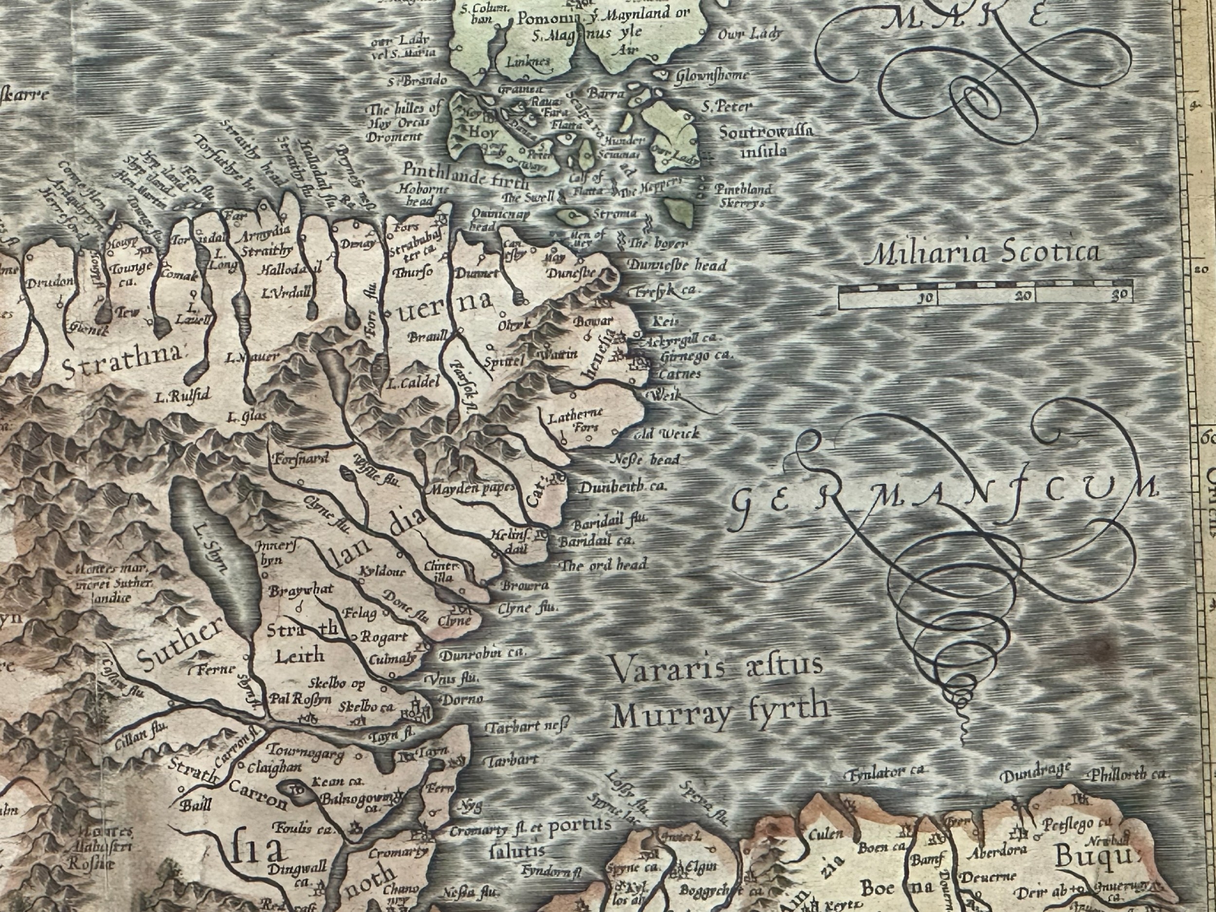
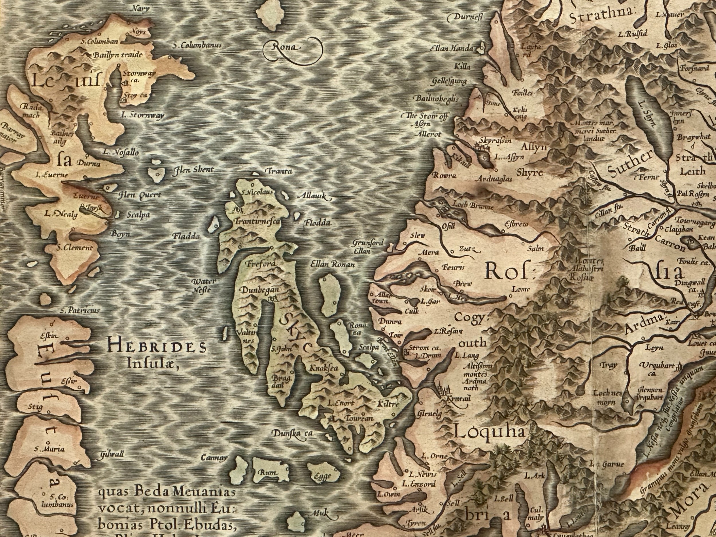
A hand-coloured 17th-century engraved map of northern Scotland, the Hebrides, and the Orkney Islands by Gerard Mercator.
1 / 5
Archive I A hand-coloured 17th-century engraved map of northern Scotland, the Hebrides, and the Orkney Islands by Gerard Mercator.

Gerard Mercator (Flemish 1512-1594) a Map of the North of Scotland Printed C.1683
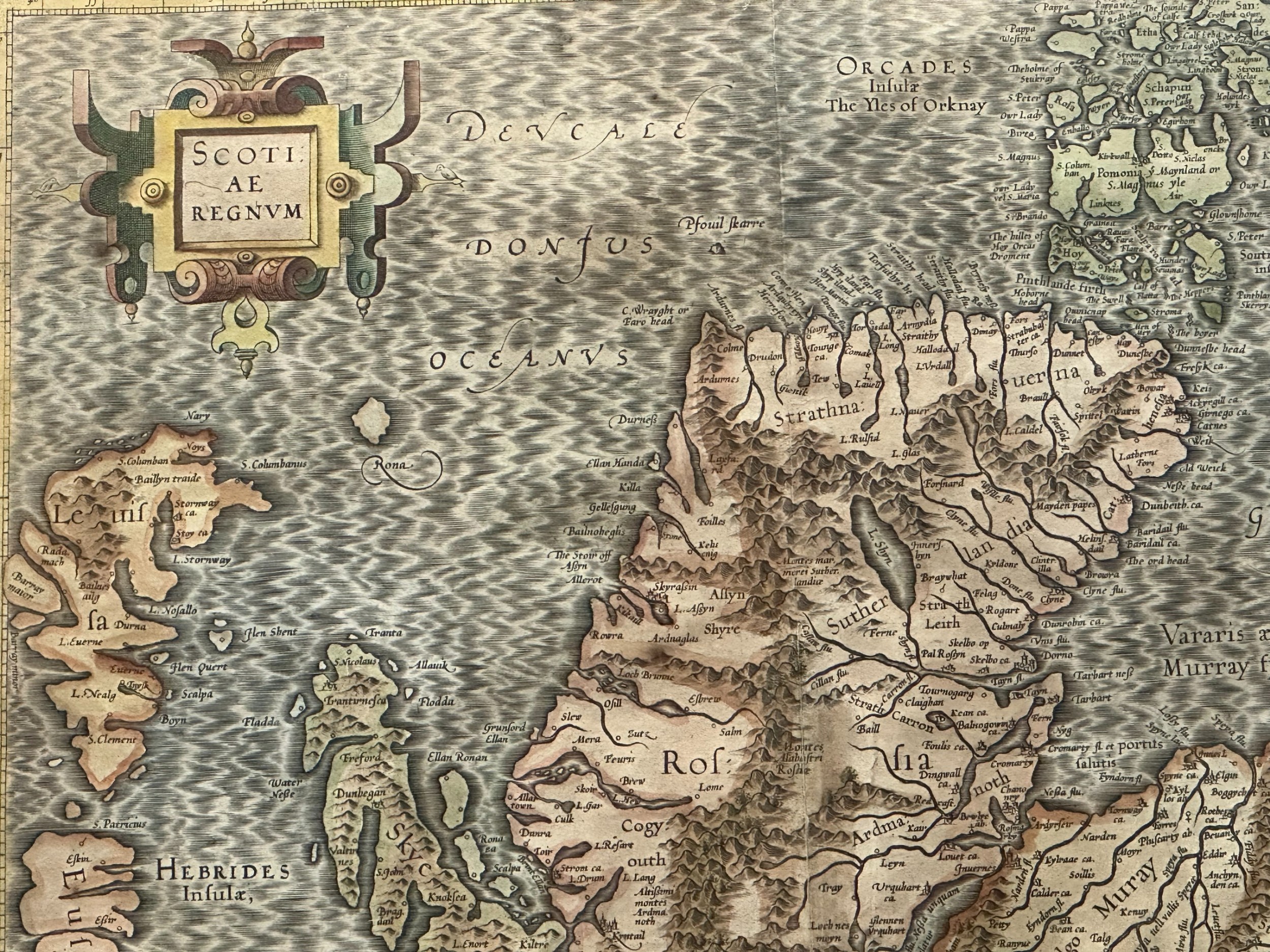
Archive II A hand-coloured 17th-century engraved map of northern Scotland, the Hebrides, and the Orkney Islands by Gerard Mercator. View II
Archive III A hand-coloured 17th-century engraved map of northern Scotland, the Hebrides, and the Orkney Islands by Gerard Mercator. View III
Archive IV A hand-coloured 17th-century engraved map of northern Scotland, the Hebrides, and the Orkney Islands by Gerard Mercator. View IV
Archive V A hand-coloured 17th-century engraved map of northern Scotland, the Hebrides, and the Orkney Islands by Gerard Mercator. View V
Enlarged Archival View
Telephone 07735 072466
Location
Edinburgh
United Kingdom
Verified Since May 2022
Items For Sale 70
Items Sold 292
Jeckyll & Co
Verified Since May 2022
View Dealer Info
Location: Edinburgh, United Kingdom
Verified
May 2022
For Sale
70
Sold
292
A hand-coloured 17th-century engraved map of northern Scotland, the Hebrides, and the Orkney Islands by Gerard Mercator.
Gerard Mercator (Flemish 1512-1594) A map of the north of Scotland printed c.1683
Ref: SA1055748
A hand-coloured 17th-century engraved map of northern Scotland, the Hebrides, and the Orkney Islands by Gerard Mercator.
Detail View 1
Detail View 4
Detail View 5
Detail View 6
Archival Detail
Every single antique dealer on our platform is individually approved by our internal team. We verify their professional trade history, ethical standards, and photographic quality to ensure a secure, high-standard buying environment. Upon joining, every dealer agrees to a strict 9-point code of conduct. While issues can occasionally arise, our dealers typically resolve them swiftly and directly with the buyer. In fact, since our founding in 2002, Sellingantiques has only had to step in to help resolve an issue on roughly five occasions—a true testament to the quality of our dealers and their dedication to your happiness.
Our dealers are highly experienced in packing and shipping fragile, high-value antiques. Because you are in direct contact with the dealer, you will be able to easily go through all available shipping and insurance options together to ensure your item arrives safely.
Antiques are the ultimate green purchase. By choosing historical pieces over newly manufactured goods, you completely eliminate the carbon footprint of modern mass production while preserving exceptional, timeless craftsmanship.

Seventeenth-century maps of Scotland, such as those published by Mercator and Blaeu, represented significant advancements in regional geographical survey and copperplate engraving during the Early Modern period.

Early printed maps were produced using incised copper plates printed onto laid rag paper with oil-based inks, after which outline colouring was often applied by hand using mineral pigments.

Authentic prints from this era typically exhibit a visible plate mark impression around the border, chain lines and watermarks in the laid paper, and central fold marks indicating inclusion in an atlas.

A framed historical map serves as a focal point when hung above a sideboard, mantelpiece, or within a gallery wall alongside contemporary line drawings or modern photography.

To prevent light damage and paper degradation, mount the print using acid-free archival materials, display it behind UV-filtering glass, and position it away from direct sunlight and fluctuating humidity.
items
Add keywords to the filter
Price
£100
£250000
Era
Movements
Material
Origin
Stock Location
Freshness
Online Payments
Categories